
In the beginning
In 1505 the Portuguese captured the Arab coastal settlement of Sofala in what is now the Colony of Mocambique and laid claim to sovereignty over the hinterland. The extent of the area was naturally unknown, but rumours of untold riches emboldened some of the more adventurous spirits of those days to penetrate inwards towards the legendary land of Ophir (Zimbabwe) in search of gold and silver. There is evidence that throughout the sixteenth, seventeenth, eighteenth and nineteenth centuries various expeditions entered the great Empire of Monomotapa, which extended from the Zambesi to the Limpopo.
On the 12th September, 1890, the wave of British penetration from the south, inspired by the genius and far-sightedness of Cecil John Rhodes, reached the spot on which Salisbury now stands. Subsequent expansion south-eastwards brought the Pioneers into Manicaland where Fort Umtali was built near the junction of the Sambi and Umtara Rivers.
This advance of British civilisation was not accomplished without great opposition both from nature and man. For instance, there were numerous incidents with the Portuguese over disputed land, but eventually arbitration settled the watershed of the Sabi and Pungwe Rivers as a rough demarcation between the interests of the two contending parties.
In 1891 Fort Umtali was abandoned, as the new B.S.A. Company had inadvertently omitted to secure the site to themselves, and enterprising gold prospectors, taking advantage of this lack of restriction on their activities, pegged the land, including the Fort itself.
In consequence the police and the volunteers then moved to Old Umtali, nine miles north of the present town, where between 1891 and 1897 a virile settlement, attracted by the prospects of extensive mineral development, sprang up and flourished.Hotels, business houses and Government buildings were erected, the telegraph was extended from Fontes Villa—then the terminus of the Railway—and the first newspaper " Rhodesia Advertiser," now called " The Umtali Post," made its appearance.
It was here, in 1891, after riding from Beira to meet Dr. Jameson, that Rhodes first saw the land which was to perpetuate his name.
With the opening up of Melsetter by the Moodie Trek and Chipinga by the Steyn Trek, the importance of Umtali as a centre of trade increased rapidly, and a party was consequently sent to cut a road to the south to enable the new settlers to bring their produce into market.
Rhodes had already given orders for the construction of the railway from Beira into Rhodesia and had promised that it would pass through the new township of Umtali on its way.Unforeseen engineering difficulties, however, made this promise impossible of fulfillment.
To assuage the natural consternation in the minds of the settlers, Rhodes offered to compensate these people once more to move their place of residence to another area which was accessible to the railway. A committee of Old Umtali residents, which was appointed at a public meeting, chose the present site to which, on receipt of £50,000 the entire population moved. The abandoned town lands of Old Umtali were presented to the American Episcopal Church on condition that it established an industrial mission for natives and a school for white children in new Umtali. This latter is the genesis of the present Umtali High School.
Rhodes's interest did not cease with the formation of the new town. He issued orders that the main highway between Penhalonga and Umtali should be maintained in perpetuity by the Government; he initiated the work of planting, in great numbers, the flamboyant trees which now add so greatly to the general attractiveness of the town; he gave instructions concerning the layout of the present Park and also presented a large tract of
land which, until recently, served as a racecourse.
The town, in its early days, was administered by a Sanitary Board. Only in 1914 was it promoted to the status of a Municipality and the Mayoral Chain now in use was a gift from the B.S.A. Company and was presented by Dr. Jameson on a visit in the same year.
General Facts
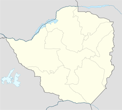
Mutare was founded in 1897 as a fort, about 8 km from the border with Mozambique, and is just 290 km from the Mozambican port of Beira, earning Mutare the title of "Zimbabwe's Gateway to the Sea". It is sometimes also called "Gateway to the Eastern Highlands". Many Zimbabwean locals refer to it as 'Kumakomoyo' (place of many mountains).There is a border railway station on the railway line from Harare to Beira with a railways mechanical work shop.
The area was the site of Chief Mutasa's kraal. In 1890 A.R. Coquhoun was given concessionary rights and Fort Umtali (the fort later became Mutare) was established between the Tsambe and Mutare Rivers. The word mutare originates from the word 'Utare' meaning gold. The name was probably given to the river as a result of gold being discovered in the Penhalonga valley through which the Mutare River runs. In 1891 the location was moved to a site now known as Old Mutare, about 14 km north of the city centre. In 1896 the construction of the railway between Beira and Bulawayo led to the town being moved a third time so that it was closer to the railway line - compensation was paid by the British South Africa Company to the townspeople for the cost of moving. The town was proclaimed a municipality in 1914 and in 1971 it was granted city status. The name was officially changed from Umtali to Mutare in 1982.
Climate Despite its tropical location, the city has a temperate climate. The average annual temperature is 19 °C, surprisingly low for its moderate altitude (about the same as Harare which is 360 metres higher.) This is due to its sheltered position against the mountain ridge of Cecil Kop which encourages cool breezes from lower altitude to the east and south. The coldest month is July (minimum 6 °C and maximum 20 °C) and the hottest month is october (minimum 16 °C and maximum 32 °C). The annual rainfall is 818 mm. Rain falls mostly in the months December to February although heavy showers are possible before and after this period. The wettest month on record was January 1926 which received 580 mm while January 1991 received only 24 mm.
